Featured Post

Thursday, February 18, 2021

September 11, 2001

 The five guys on the First Whitney hike talked about getting together each year to do more similar hikes.  I usually selected September for these kinds of trips.  Kids were back in school, crowds were smaller after Labor Day and the weather was beginning to cool a little, without much risk of winter like conditions.

We did not really do anything like that in 2000, but in 2001, Lloyd was going to be the planner and what he came up with was a hike and camp on the Pacific Crest Trail, near Lake Tahoe.  

https://goo.gl/maps/6Xc2WfxwGYDAetNd7

This is not exactly what we planned and it is not exactly what we did, but it is close and is the best I can come up with on Google Maps.  We would be starting on the PCT just off Highway 50 at Lake Aloha Trailhead.  Then we would stay on it and find a trail down to Lake Tahoe. It was going to be a 4 day hike.

One of the problems was figuring a way to get back to our rental car at the trailhead after the end of the trip.  After considering several options, we learned that Lloyd solved the problem for us, but it had its downside.

He had been adding lime or something to his lawn, wearing shorts and boots, when he began to notice a gritty feeling on his ankles inside the boots and socks.  When he took them off, he saw that he had really bad chemical burns on both ankles.  The stuff he was spreading had gotten down in his socks.  I'm not good at remembering degrees of burns and stuff like that, but when I saw them, they looked really bad and painful.

He decided he could not do the hike, but planned to jumpseat to Reno hang out with us and drop us off at the beginning point and pick us up at the end.  In the mean time, he would visit some railroad museums and stuff like that.  What a guy. 

The hiking group would only include Bobby Z, Snake and myself.  Chuck was unable to join us for some reason.  Bob, Lloyd and I arrived in Reno the night before we planned to start hiking and stayed at our UPS layover hotel, the Hilton, which had a casino on the first floor.  It was September 10th, 2001.  Lloyd and I shared a room and Bob would share his room with Snake, when he arrived later in the night.

We were up early for Reno time, but it was before 0800 on the East Coast.  Lloyd had used the bathroom and I was in there shaving or something when I heard him call from near the tv.  I stuck my head out the door and he said, "The World Trade Center is under attack".  I said something brilliant like, "What?"  He repeated himself and said that 2 planes had been flown into the WTC in New York.  

He had turned on the news and was watching the live video of the burning North Tower, when suddenly, another plane flew into the South Tower.  At that point, everyone realized that this had not been an accident.  It was an intentional attack.  Who?  Why?  To me, why did not matter.  What kind of asshole group would do something like this.  Whoever it was, I didn't care what was their motivation.  I wanted long, slow revenge.

We quickly got ready to go to a restaurant downstairs and talked to Bob and Snake.  We were standing together in the lobby, watching the smoke rising from the buildings on a tv down there.  We ate breakfast and I don't remember much about the conversation.  We considered what we should do.  

We learned that all air traffic was shut down, so flying home was not an option.  Renting a car and driving was considered, but ruled out.  We decided we might as well go with Plan A and do our hike.  Lloyd was going to stay at a hotel at South Lake Tahoe.

As we drove to the trailhead from Reno, we listened to the radio and were learning more about the attack.  I don't remember if we saw the towers collapse live or just replays.  I do remember seeing bodies falling from the towers before they collapsed and remember the deep, burning anger that was building inside me.  At that point, I would have gleefully peeled the skin off anyone who had anything to do with this horrific attack on our country.  We all called home, said all the reassuring things we could say and told of our plans to press on with the hike.  Chances were good that things would be somewhat restored by the time we were finished, but we would see what we had to deal with and reassess at that time.  I don't remember if the perpetrators had been identified before we stepped off into the woods.

Lloyd took us to a parking lot, we unloaded our backpacks, said goodbye and headed north on the PCT.  It was a beautiful hike, past lakes and climbing gradually.  Snake had brought a tripod, because he fancies himself a photographer.  It looked like extra weight to me, but he is much younger and was a much faster hiker anyway.  As usual, I was lagging behind the other guys.  

Eventually, we got to Lake Aloha, which I believe is a manmade lake, created to store water to irrigate the very thirsty state of California.  This is in the Desolation Wilderness, which strangely enough, looks like a desolate wilderness, very strange looking.  We dropped down a little to the east and found a nice primitive campsite near a small lake and called it a day.  

The next day would be a climb over Dick's Pass, then a descent to the Velma Lakes, where we would find a place to camp.  As usual, I was behind the guys all day.  As I climbed to Dick Pass, I could see what looked like a thunderstorm building and I was really pressing to get over the pass and away from the storm.  Bob and Snake were waiting for me at the pass and I steamed past them, saying I was being chased by a thunderstorm.  I think they thought that was funny, because the storm cloud had dissipated by then.  

Down we went and they could even pass me on the way down.  We found a cool, place to camp, surrounded by big rocks, that kind of reminded me of Trail Camp on Mount Whitney, only the air was not as thin, there weren't any other people and there wasn't lots of poop laying around on the ground, contaminating the pond where we got drinking water.  

Bob and Snake must have been talking about how much I was lagging and decided to cut the hike a day short and drop down via the shortest trail to Emerald Bay, instead of doing another climb to another pass.  I was OK with that.  I think we were all anxious to learn what we could about the attacks.

We cell phone called Lloyd and he picked us up.  We checked into a hotel, ate dinner at a casino buffet in the Nevada side of South Lake Tahoe and got up to speed on the news.  By this time, we were learning more than we wanted to know about Osama Bin Laden and Al Qaida.  The air system had been restored and we could travel back to our homes.

As we camped on the trail, it was eerie not to see any planes flying over.  We knew that we were on the routes that planes fly into and out of the San Francisco Bay area.  We did see a helicopter or 2 and heard a turbo prop plane one night.  I'm guessing they were government related, but who knows?

Saturday, February 13, 2021

First Whitney

 OK, Mt. Whitney was an obsession.  It was an itch that just needed to be scratched.

You know I was going to drag Lloyd into this.  He was afraid that if he didn't go, I would just do it myself.  He was not going to let that happen.  However, he thought we would need to bring someone who had more experience than we had.  

Our pal, Chuck H., from the Flex days, had also been hired at UPS.  He was a bona fide hiker and camper, very fit and knowledgeable.  We convinced him to join us.  

Lloyd commuted to Louisville from Orlando to go to work.  He had a crash pad there and usually came a day early, so as not to be fatigued when he flew.  He often tried to get some of the old Flex gang, who had come to UPS and moved to Louisville, together for dinner, when it worked out for him.  On one of those occasions, Lloyd and I were talking about our big, planned expedition and the wife of our pal, Bobby Z. heard us and said she thought Bob would like to join us.  Cool.  The more the merrier, as far as I am concerned.

Bob and I needed to buy some camping equipment, so we went to Quest Outdoors (love that name and their motto, "Climb Every Mountain"), to buy our stuff.  When we were there, we saw another UPS pal, Snake, and told him what was up.  He said he would like to join us also.  The problem was, by that time, I had obtained a permit for 5 and my brother Kevin had been considering going.  We did not have an opening, unless Kevin dropped out.  Snake was on standby.

I pressed Kevin to make a decision and he eventually decided to drop out, he had a knee that was surgically repaired when he was a teenager.  So, 5 UPS pilots, 4 of whom were former Florida Express, were going to attempt the reach the summit of the highest mountain in the United States, excluding Alaska.

There are several ways to do that.  The most common and shortest way is to hike the 11 mile Mount Whitney Trail, from Whitney Portal.  That is the way we were going to do it.  The next choice was to decide how many days we would take to do it.  Our original plan was to take 3 days.  The first day we would hike 6.3 miles to Trail Camp, at 12,000 feet.  Then we would camp, leave our gear there, except what we needed for a day hike, go to the summit and then return to spend another night at Trail Camp, before returning to the Portal.


Some people do this hike in one day, but we were going to be cautious and not push our luck.  Since this hike begins at 8,300 feet at Whitney Portal and climbs to 14,500 feet, we had to respect the thin air and the challenges it presents to the human body.  None of us had ever been that high on a hike and did not know how it would affect our bodies.

I had been reading The Whitney Portal Store Message Board.  There was a story about a group of young guys from San Diego, who were all marathon runners and very fit.  They drove to the Portal, spent part of the night sleeping in the car and started up the mountain at a fast pace.  At about 10,000 feet, one of the guys began to have a headache and feel a little nauseated.  He pressed on.  By the time he got to 12,000 feet, he was really falling behind his pals and became almost knee walking sick.  His friends had to abandon their hike and help him back to a lower elevation.  He recovered, but he was the one guy in the group who could not handle the rapid change to thinner air.  You never know who it will be or when it will happen.

High Altitude Pulmonary Edema (HAPE) and High Altitude Cerebral Edema (HACE) are conditions that occur rarely to people who ascend to 14,500 feet or more, but they do occur.  If the ascent is made too rapidly, they can occur more easily.  I had been doing lots of research, including reading about attempts to climb Mount Everest.  Whitney is only half the elevation of Everest, but it must be taken seriously.  Everest climbers spend lots of time and energy acclimatizing to the thin air of high elevation.  The base camp for Everest is at around 18,000 feet.   In preparation, climbers go up to higher camps and return several times.  Into Thin Air is a book by Jon Krakauer about the disastrous 1996 Everest climbing season and discusses all the issues.  There has been a movie made, which was based on the book.  It is not nearly as informative as the book, for someone preparing a high elevation hike.  One of the important issues revealed in both the book and the movie, is the wisdom of knowing when it is appropriate to begin descending, even though you have not reached the summit.

With every member of our expedition being active airline pilots, I was a little less concerned, because we all spend lots of time at high cabin altitudes in our pressurized jets, but never as high as 10,000 feet and never exerting as much energy as a hike at those altitudes.

Lloyd, Bob and I arrived in Ontario California a day early.  We were able to ride the company jumpseats there, Lloyd and Chuck from Orlando and Bob and I from Louisville.  Snake would arrive early in the morning of the day we would drive to Lone Pine CA.  Lone Pine is the single traffic light town on Highway 395 just east of our objective.  We rented a minivan and I drove to Lone Pine.  

When we arrived, we could see that the top of the great eastern wall of the Sierras was obscured by a dark cloud base and rain.  We went to the hotel at which we planned to sleep when we returned after the hike.  (I forgot to give them my credit card and there will be more about that later.)  Our plan was to eat a meal in town and drive up the 13 mile road to Whitney Portal, while hoping that the rain would stop before we got there.


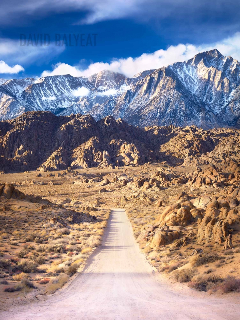
We drove west through the amazing Alabama Hills and began to climb across an open area, with the impressive Sierra wall before us.  It was hard to see how we would be able to drive up there.  It was not yet apparent that there was a huge switchback to the right, then back to the left, before the road entered the canyon that led to the Portal.

The cloud base was about 9 or 10 thousand feet above us, near the tops of the highest mountains.  Suddenly, a two pronged bolt of lightening came down from the clouds directly in front of us and struck the ground on either side of the road.  The lightening looked like the two bowed legs of a giant cowboy.  The exclamations we all made highlighted the impression this event made on 5 highly experienced airline pilots and military veterans.  The visual is burned in my memory-10,000 feet of lightening bolt.😮

As we recovered from our surprise, we began to see the switchback.  Upon arriving at the base, we turned right and began to encounter rain.  On this northbound leg, the road was in pretty good shape.  As we made the 180 degree left turn to the south, we began to see that huge rocks had been washed down off the side of the mountain, creating an obstacle course for the heavily loaded minivan.  Swinging left and right, we avoided all but a few smaller rocks and were concerned that the road would be closed at some point.  It was not.

We found the Whitney Portal Store, parked the van and went in to do some last minute shopping and wait out the storm.  I had reserved a large campground, big enough to park the van and have room for our tents.  We drove the short distance after the rain stopped a few hours later.  There was a small Class C camper next to us.  We set up our tents, started a fire, prepared dinner and told lies and war stories.  We planned our departure time and went to sleep.

Lloyd and I had identical Sierra Design 2 man tents.  Bob would share mine, Chuck was with Lloyd and Snake had a little bivvy, that would have made me claustrophobic.  You had to be horizontal, no sitting up in that tent.  In the morning, we decided to share the weight of the 2 tents.  Bob carried part of mine and Chuck carried part of Lloyd's.  This would prove to be a major mistake. 

I should have known better.  On our previous hike together, the San Gorgonio Death March, we learned that Lloyd hikes much faster than I do, especially climbing at high elevations.  On this day, it would be proven that Bob, Chuck and Snake hiked even faster than Lloyd.

I had read 3 books about hiking the Mount Whitney Trail.  I was literally aware of all the landmarks on the climb and remembered most of them, at least when my brain was not fuzzed out by the thin air.  Even with that, there were some psychological challenges I was not prepared for.  

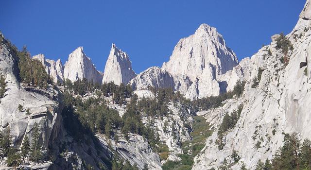
For the first several miles of the hike, there are several spots from which the summit is visible, if you know what to look for.


As you look up this chute, you are seeing the use trail that leads to the base of the East Face of Mount Whitney, which is climbed by real mountain climbers, as well as the Mountaineers Route which was pioneered by the famous John Muir.  The problem is that when you see it, you have to crane your neck, looking WAY UP THERE.  It seems unbelievable that you will ever make it.  However, it is just like many other struggles in life.  When you have your lofty goals, you deal with what is immediately in front of you.  You take one step at a time.  This was going to be lots of steps, at high elevation.  

Lloyd kind of waited for me occasionally, much as he had done on the Death March.  The other guys were long gone.  I remember meeting a couple young guys, with whom we were doing the tortoise and hare thing.  As we were climbing a set of the many, many stone steps, one of them taught me a technique I have always remembered. He said it would save energy to place the entire sole of the foot on the step, from heel to toe and use the big muscles of the upper leg to push up, as opposed to just placing the ball of the foot on the step, which requires the use of the muscles of the lower leg.  The latter can be very tiring on a long climb.

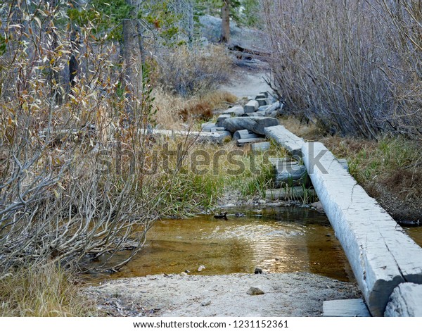
After passing the beginning of the use trail to the East Face, we traversed to the southwest and followed Lone Pine Creek.  Therefore, there is water available at almost all times.  Also, the view of the summit is blocked and the thoughts of how high and long this climb will be goes to the back of your mind.  After several trail switchbacks, we come to a place where a log bridge was built to keep our feet dry as we walk up Lone Pine Creek in a relatively level section.


At the end of that, we pass the cut off to Lone Pine Lake.  We would not be visiting this beautiful spot.  I did make it up there several years later.  I will show some of our photos in a later blog.  Not far from there, we pass a sign that announces our entry into the Whitney Zone, which was created to protect the environment there and requires a permit to enter.


This trail is 11 miles from the Portal to the summit.  The Google Map in the hyper link above shows a little less, but represents the horizontal distance, without regard to the vertical measurement.  Therefore the actual distance covered is like the hypotenuse of a right triangle.  (I was pretty good at plane geometry in high school and this is all I remember).  As we climbed above 10,000 feet, the trail leveled for a little distance, until we passed Long Horn Meadow and Outpost Camp.  Outpost camp was a primitive campsite, except for the presence of a solar outhouse.  WTF is a solar outhouse, you may be inclined to ask.  I know I was.

It is an environmentalist wet dream attempt to process human poop, using solar panels, in the hope that people could poop in the building, without introducing any of their urine.  Even our resident environmental whacko, Snake, realized how difficult it is to "relax down there" enough to do a 2, without allowing a 1.  At any rate, the system was out of service, probably because of the introduction of liquid, that was inevitable.  The solar outhouse at Outpost Camp was closed.  There was another at our Trail Camp, our destination for the day.

Climb, climb, climb, steps, steps, steps, waterbars, waterbars, waterbars, rocks, rocks, rocks, switchbacks, switchbacks, switchbacks.  Another small respite at Trailside Meadow, before the final climb to Trail Camp, at 12,000 feet and 6.3 miles up the trail.  This is where Lloyd and I were when we first encountered the rain of the day.  This was before I began to remember times, so that I could calculate my speed in miles per hour, but I'm betting it was not much faster than 1mph, with my backpacking load.

Just before reaching the level, rocky spot that is known as Trail Camp, we could see Consultation Lake off the trail to the south.  I always get a kick out of hearing people mispronounce that name.  Thank you Sisters Of St. Joseph for making me a nerd about things like that.  By that time, it was raining like hell.  Actually, we were walking into it and our much faster pals, who mercilessly left us in the dust, had been standing there in the cool ambient air, getting drenched, with only part of each of the 2 man, Sierra Design tents.  Ha!

Seriously it was not a pleasant situation.  They had scouted out good spots for us to set up our tents.  As I pulled my share of my tent and Bob pulled out his share, I heard Snake say, "I don't want to seem melodramatic, but this may be a survival situation".  I said, "I don't think you are being melodramatic, it is a survival situation".  My hands were shaking from my much briefer exposure to the cold, wet conditions and it was hard to articulate the process necessary to set up the tent.  Hypothermia was a real possibility.

Long story short, we got the tents up, got inside, changed into dry clothes and the rain stopped early enough for us to pump some water from the nearby pond and prepare our evening meal.  We heard what I thought was a jet flying over.  Snake was the first to realize it was a giant rock slide from the wall to the southwest of Consultation Lake.

As Lloyd and I were on the final struggle to Trail Camp, the other 3 guys had been talking to other people there.  Some of them had tried going up the next section of trail, known as the 99 Switchbacks and decided to retreat in the face of the storm.  As they climbed into colder air, there was ice forming at a difficult section known as the Cables.  No one came out and said it, but I could sense that my pals were in the early stages of deciding to turn back for the trailhead in the morning, instead of pressing on to the summit.  I was very disappointed, even though I knew that I was the slowest hiker.  I had learned my lesson from reading Into Thin Air and from my own Death March experience.  I would turn back if that was what the group decided, but I would have great regrets for not "going and taking a look at it".  Pilots can relate to that quote.

As I often say, darkness comes early to the east side of a mountain.  As my spirit was at its lowest, Chuck pulled out a flask of Scotch, passed it around and said, "Take a swig of this, get in your sleeping bag and go to sleep.  Set your alarms for 4 AM.  We are going to the summit tomorrow morning".  I love that guy.  At Florida Express, he was a good friend, who was known for quietly and efficiently getting the job done, unlike some of the s#!t magnets we had there.  He literally made this trip for me in that 1 minute, inspirational speech.  The other guys would have to have exposed their pu$$ine$$ to argue with that.

I tried to count the 99 Switchbacks while climbing them on a later trip.  The crazy thing is that I got a different count on the way down that day.  Whatever, I never got more than 97, but I guess 99 sounds cooler.  Regardless, they are a b!tch.  Once again, the psychological entered the picture.  When the sun finally began to appear in the east, we could once again see the summit.  That means that every time we got to the north end of one of the switchbacks, we saw pretty much the same thing as we had just seen a few minutes before.  It never got closer.  Back and forth, back and forth we went.  The other guys just took off and disappeared.  Lloyd laid back a little and would shout down encouragement from several switchbacks above, but eventually, he got summit fever and I told him to press on.  I told him I may not be able to go all the way. 


I was not feeling well.  I had taken Diamox, a drug that is supposed to help with altitude sickness.  On subsequent trips, I learned that it was not necessary.  I never got sick or had a headache.  I was just slow and had to rest frequently.  I did not sleep well and don't know if it was because of the drug, the thin air, the tight quarters in the tent or the midnight pee breaks we semi-geezers had to take.

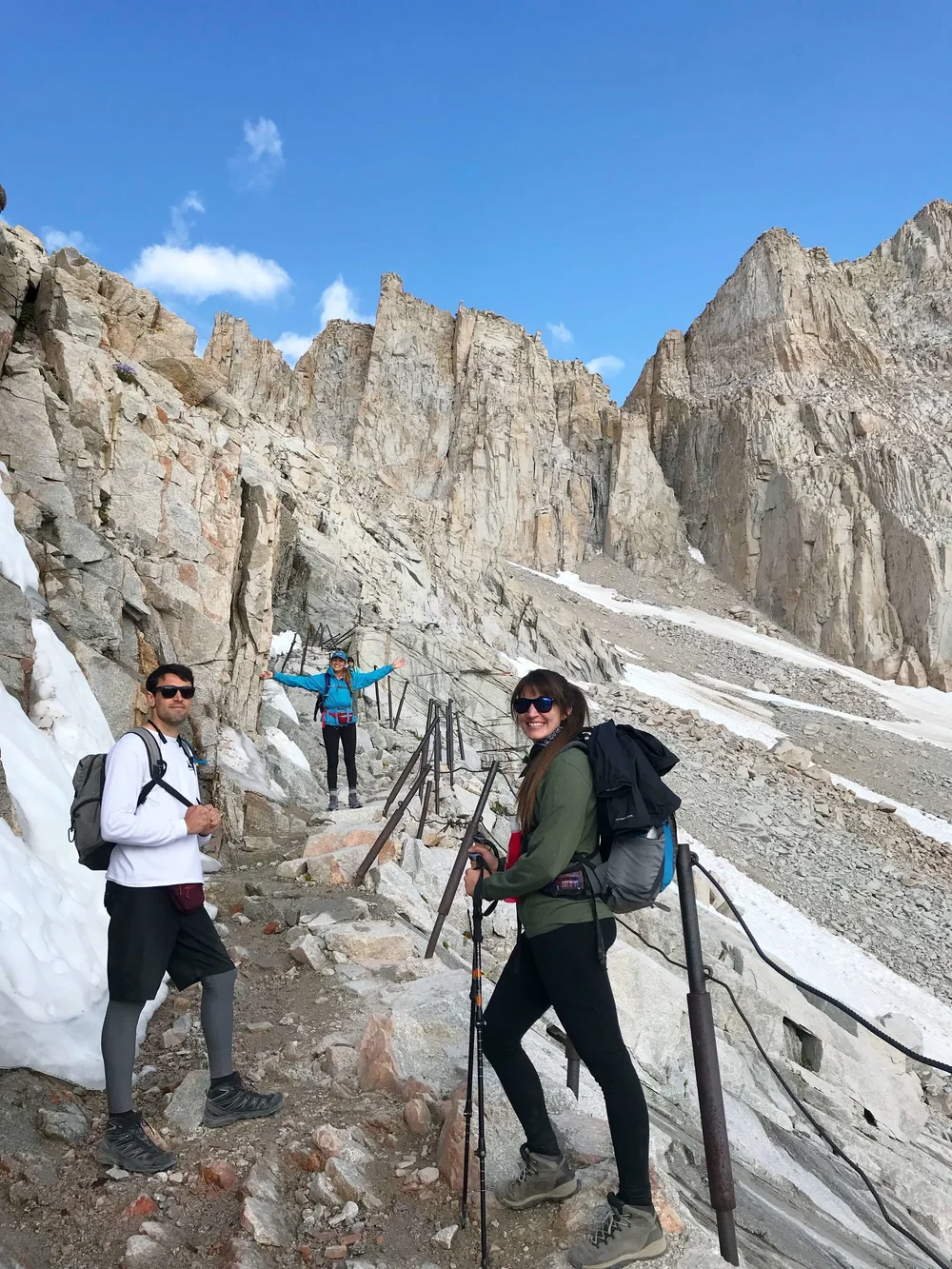
I finally made it to the cables.  This is a place where the switchbacks bend around to face more to the north than the east.  It is narrow, there is a rock wall to the left and a deadly fall to the right.  The trail has rocks that are difficult to walk over and around and there is water seeping out of the wall that freezes on the trail that has been blasted into the wall.  The cables are thin posts that have been sunk into the rock, with a thin cable running along the trail for a short distance.  Frankly, I think it would be quite easy to slip under the cable and fall to your death.  The cables are next to useless.  I can say this with confidence, because I have read on the Whitney Portal Store Message Board, that this exact thing has occurred.


I learned later that one of the faster guys had sat down here and was going to call it a day, until one of the others teased him into pressing on.  I will let you guess who those two were. 


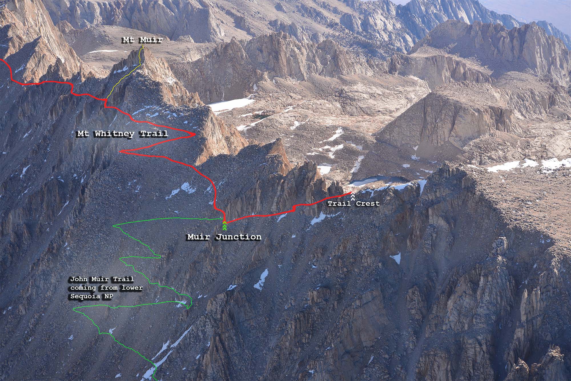
Being left behind, and seeing how much higher and farther I had to go, were tough.  I worked my way up the trail by setting short term goals.  I will go to that rock.  I will go to that next switchback.  It was tough when I had to stop to catch my breath before I got to one of those short term goals, but I decided to go to the top of the switchbacks, known as Trail Crest and wait for my friends to return.  Trail Crest is where you go over the summit at a pass, to the back, western side of the divide.  It is at about 13,700 feet.  I was really feeling like crap, but I was about to learn an important lesson.

The view from Trail Crest was breath taking, to both sides.  It was like standing on a knife edge.  I could look back to Trail Camp and see the little pond from which we filtered our water and a tiny rectangular building that was difficult to see.  That was the solar out house, which was also closed. 


We all had eaten breakfast and done our morning necessities.  Snake came back describing how nice and warm it felt to pick his up with the little plastic bags we had gotten at the ranger station.  Consultation Lake was to the right. 


I found a little rock ledge at Trail Crest, that was just the right height for me to sit on, as I enjoyed the views.  I began to eat a Clif Bar and drink some water and Gatorade and suddenly, I began to feel better.  This taught me that we can loose our appetite and sense of thirst at high elevations and therefore should plan to eat and drink at regular intervals, not wait until we are hungry and thirsty.


I was going to press on for another half mile, to the point where the John Muir Trail climbed up the western side of the ridge, to join the Mount Whitney Trail and continue to the summit.  I knew that this would be a descent.  I didn't know that it was steep and rocky and practically required a butt slide going down and a hands and feet scramble on the way back up.  I did it in short time and when I got to the JMT, I felt well enough to press on.  My thought was to go until one of the other guys passed on the way down and then turn back with them.  I knew I would be faster going down.  

Snake was the first I encountered and my brief discussion with him encouraged me to press on a little longer.  The trail on the back side of the ridge is like nothing I have ever seen.
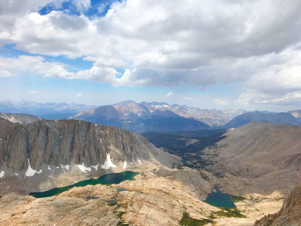


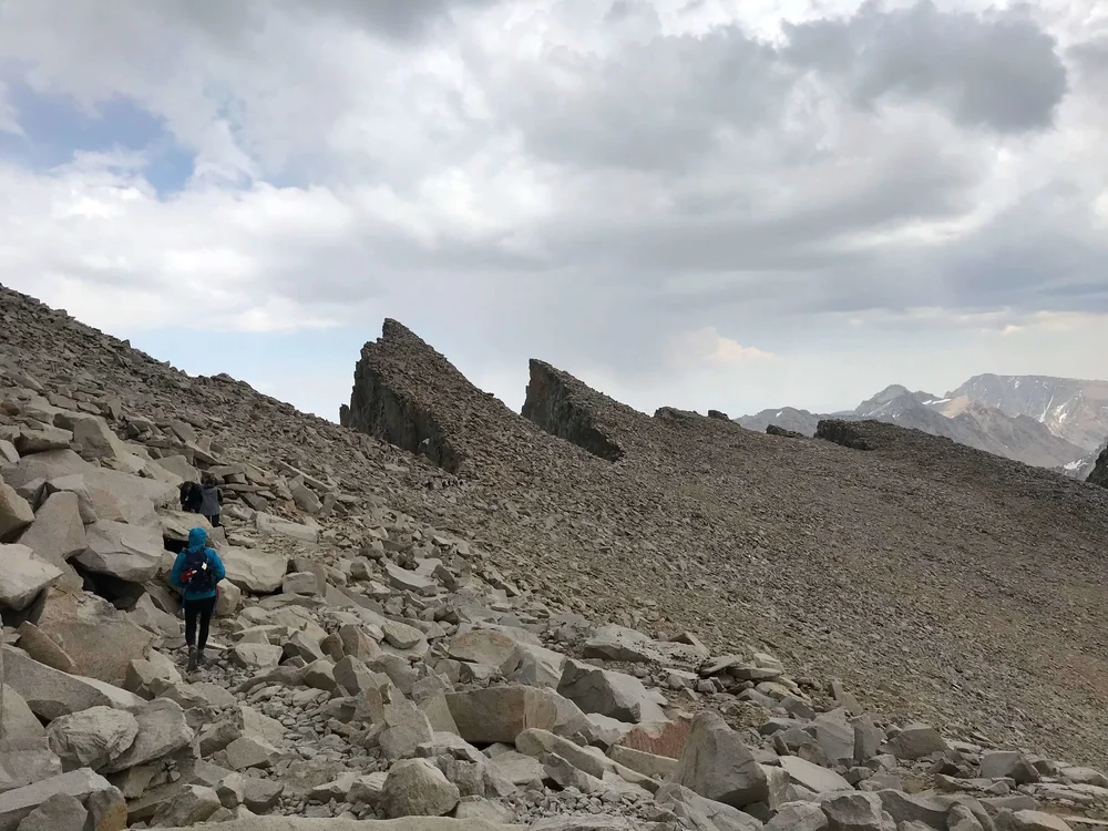
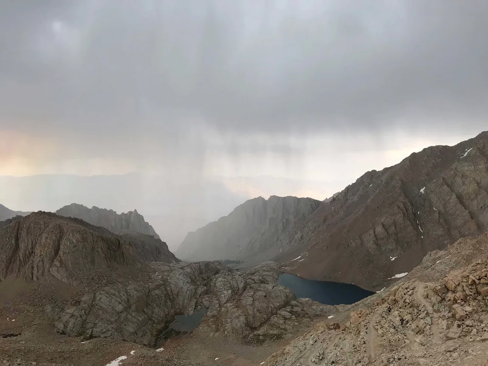
So, onward and upward I went.  I gave up about 500 feet of my climb to Trail Crest when I went to the JMT junction.  From there I began to regain it.  You can see from many of the photos that there are several smaller peaks along the ridge south of Whitney.  They and the spaces between them are called the Needles and The Windows.  The trail passes at the bottom of several of these windows and it is possible to look down a very long way to what lies below the ridge.  It is important to be very careful with your footing back there.  There are some places where a stumble could lead to a long fall before you would ever hit something.  Eventually the trail arrives at a place to the west of the summit and turns east for the final climb.  There are huge boulders strewn all over the back side of the mountain.  As I passed Lloyd, he warned me about a place where there had been a rock slide that blocked the trail, requiring a hands and feet scramble for about a hundred yards.  

Soon I could see the top of the Stone Hut at the summit.  It was built by the Smithsonian Institution in 1909.


There is a sign in book at the hut and I have a picture somewhere of myself standing there, but Snake lost it.  

OK, I found a way to get that photo, but Snake still lost my CD.

I walked to the East Face, not too close, and looked down.  I took some other photos and knew that my friends would be waiting at Trail Camp, so I headed down.  With gravity on my side, I could move much faster, but I still had to be careful not to fall.  Descending has its own problems.  If you fall forward, the angle is greater and the injuries would be greater.  It is possible for your feet to slide out from under you on certain types of surfaces.  For some reason, descending for a long time is painful to the knees.  That is probably because your upper body is constantly trying to fall forward and you are holding it back.  Your feet can get jammed forward into your boots, if you don't retighten your strings and you can damage toe nails.  People have lost toe nails because of this.

The feeling of accomplishment, the return to thicker air, the ease with which you move, compared to the climb and seeing all the spectacular views from the other side are all exhilarating.  Upon arriving at the John Muir Trail, I was faced with the prospects of making the half mile, 500 foot scramble back up to Trail Crest.  After 2 miles of descending, my body was shocked at the necessity to climb again.  I noticed this rebellion at a couple other short climbs on the way down.  The muscles that had gotten me to the summit did not want to climb again until after some considerable rest.

When I got to Trail Camp, the guys had packed their camping gear and decided to go down to Whitney Portal, instead of spending another night sleeping at 12,000 feet.  We still had lots of daylight and of course, were prepared to hike in the dark also.  The last few miles were in the dark and the store was closed.  We drove the 13 miles back to Lone Pine and discovered that since I had forgotten to give my credit card info to the hotel, we did not have rooms.  We drove to another little hotel and they had some vacancies.  We also discovered that our bodies had stiffened so much on the short ride, that it was hard to move.  Showers, dinner and a good night's sleep made us good as new. 

This was in September of 1999. 


Sunday, January 24, 2021

Died And Went To Heaven

"Died and went to heaven", "in hog heaven", these were things my old first sergeant said all the time.  He usually applied it to a situation in which someone had come upon a pretty good deal.  That is how I would describe becoming a captain on Boeing 757s and 767s at UPS.  

I remember when those airplanes first came on the scene, it was around the time I started being an airline pilot at Pacific Express.  I was flying old, beat up BAC 1-11s and these newer planes were way off my scope at the time.  I was hearing things about what they did and it was like science fiction to me.  Now nearly 15 years later, I was flying them.  

At first, there was one domicile for these planes at UPS.  That means all the pilots on that plane were on one bid.  The domestic and international flying was all done by that domicile.  Later, the company would split off all the international flying to another bidding domicile and later there would be another in Ontario CA and one in Miami, for Latin America flying.  When I started flying them and the 767 was brought onboard, I was able to bid some trans Pacific flights to Narita, the Tokyo international airport.  I had done this before on the classic 747s. 

The new planes, with their glass cockpits and flight management systems made the work much easier. I wasn't too worried about having 2 fewer engines, because the engines on these jets were much more reliable.  I had been involved in about 3 engine shutdowns inflight on the Whale.  The good thing was that you could proceed to your destination on 3 engines on a 4 engine airplane.  If you lost an engine on a twin, you had to land at the nearest suitable airport.  In nearly 15 years flying the 75/76 and a year on the 747-400, I never had to shut down an engine.  In 4 years on the DC-8 as an engineer, I never shut down one of the CFM 56 engines they had been retrofitted for.  The newer turbo fan engines were becoming very reliable.

As I said before, income was increasing and eventually, I was making much more than I had ever made before.  Except for the challenges of working for UPS and flying mostly at night, this was becoming the career of my dreams.  I was in hog heaven.  Ol' Top would have agreed.

Thursday, July 23, 2020

Death March

I was talking to one of my friends, Lloyd, about some of the mountain hiking I had been doing.  As it turned out, he had been doing the same thing.  

Lloyd had hiked to the summit of the highest mountain in Southern California, Mount San Gorgonio, via the South Fork of the Santa Ana River Trail.  San Gorgonio is north of Palm Springs and is 11,500 ft. high.  There are several trails to the summit and I have mentioned attempting the Vivian Falls Trail in the previous post.  That was actually later than the hike in this story.  I insisted that Lloyd join me on a hike using the South Fork Trail.  He went for it.

https://goo.gl/maps/296akZT4mVdTQgYr7  

I had a layover in Ontario CA coming up, that gave me enough time for the hike, or so I thought.  I would fly into ONT from Rockford IL, get a few hours sleep, then meet Lloyd early enough to drive to the trailhead by 0600.  Lloyd was on time off and jump seated there to meet me.

The weather was lousy that morning in the Inland Empire.  We grabbed a quick breakfast and began driving east on I 10 (the 10) in the rain.  As we began driving up California Highway 38, the rain became heavier and I could read Lloyd's mind.  He was thinking I was crazy for doing this and that he was crazier for joining me.

https://goo.gl/maps/iCuv38aJnVsVosrFA

Then at about the spot where the map above begins, we broke out on top of the clouds.  We could see the stars above and the tops of the clouds below.  It was beautiful and I could hear Lloyd thinking, "Shit".  It was just like what we often saw when climbing to our cruise altitude in the jet.  I was relieved, but I think I would have wanted to hike even if it was in the rain.  That would have added more to the dumbness than what we actually did.

When we parked and began donning our backpacks the sun was just beginning to let its existence be known to us.  It was cool and we were only at about 6,000 feet elevation.  We felt that we had plenty of time to hike to the summit and back.

We planned to follow the route that Lloyd had used before.  He had hiked with a guy with whom he was flying.  I remember him telling me that his buddy had gotten blackened toe nails as a result of boots that were improperly fitted.  You can see that route as the blue line in the first map I linked to above.  The gray line is an alternate route I will discuss later.

The hike up to the split was a nice walk in the woods.  We passed a paved road and an old campground used by people who were passing through the mountains in this area.  We passed a place called Poopout Hill.  Not sure what that was all about.  Maybe it was named by someone who got tired and ran out of gas.  I saw no evidence to disprove that.

The trail was just a typical western mountain trail, with sand, rocks and roots to negotiate.  No biggy.  There was a creek near the split in the trail and we refilled our bottles.  This was the last source of water and we still had many miles to go.

From that point, the trail gets steeper.  The map shows only 9.6 miles to the summit that way, but it is actually more like 11 miles, because the map assumes only 2 dimensions and the third dimension is rough.  It's like the hypotenuse of a right triangle. As we began climbing, the trail started to the south, then switched back to the north and then south again.  As we rounded that turn to the south, we came upon a young man and woman.  She was in the process of peeing on the side of the trail.  We surprised them pretty good, but politely went back down the trail, around the bend.

Eventually, we came to the trail that went a short distance to Dollar Lake.  I can remember Lloyd pointing to a spot above and saying it was Dollar Lake Saddle.  From where we were to there looked like it was going to require a lot of switchbacks and it did.  This was the difference between trails in the mountains of the West and those of the East.  Back east, the trail designers didn't seem to understand the concept of switchbacks.  It was as if they said, "There's a hill, let's go up there".  Then they just went straight up, regardless of the steepness.  I have experienced trails that were a hands and feet scramble going up and a butt slide going down.  Unbelievabe.  On western trails, there were so many switchbacks, you might cover 2 or 3 times the distance or more to get to a higher position.  I think it was because the designers were being humane to the pack animals many of these trails were designed for.


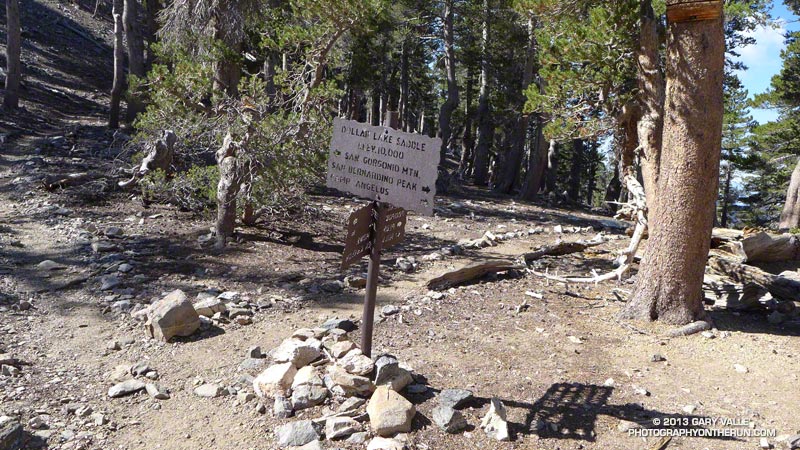
Dollar Lake Saddle was a big trail junction.  The trail to the Gorgonio summit was to the left, a trail that went down to join the Vivian Falls trail was straight ahead and down and a trail westward to San Bernardino Peak went up and to the right.  The elevation is 10,000 feet and I was beginning to feel the effects of not getting enough sleep and the thin air of high elevation.  I remembered from my general aviation days, that the air density at 18,000 feet is half that of sea level, on a standard day.  For example, an airplane engine that produced 400 horsepower at sea level, would produce only 200 at 18,000 ft., without a super charger, because of the thin air.  The performance of a human would have a similar drop in efficiency, maybe worse.

I felt as if I needed a nap.  Lloyd went along with all this.  I tried to sleep, but it wasn't happening, so I got up and we pressed on.  There was a geezer who we kept seeing on the trail.  We would pass him, then he would pass us.  Finally, he just kind of left us in the dust, because I was really dragging ass.  I think that guy was going down a shorter trail from the top and having someone pick him up, so he wasn't worried about getting back to the same trailhead.

We weren't either, but we should have been.  I was thinking that this would be my last time ever to attempt this hike and I wanted to get to the summit.  I'm guessing Lloyd was and, in my fuzz brained way, I was crunching the time numbers and began to realize we were running out of time to do all that.  I simply couldn't go any faster.  When you do hikes like this, you have to make an educated guess as to how much time it takes to get back to your trailhead and establish a bingo time for climbing.  When you get to that time, you turn back.  We were blowing right through our bingo time, but not discussing it.  Dumb.

Lloyd was feeling good and would press ahead, then wait for me.  I began having weird micro-hallucinations.  I would think I was seeing a rock or tree shake slightly, as if there was an earthquake.  A couple times, I thought I saw Llyod's face hiding behind a bush.  These were all the creations of a mind that was fatigued and starving for oxygen.

We reached Dry Lake View, which was the top of a cliff, from which you could look down to Dry Lake on the other trail to the summit.  I'll bet you have already grasped the meaning of the name.  This lake would fill with water during the Spring thaw and then dry up later in the summer.  

From there, the trail traversed the ridge to the west.  As we rounded the western shoulder of the ridge, there were ancient trees that bore the brunt of the winter winds at this high elevation.  We were nearing 11,000 feet.  We switched back to a southeasterly direction and would soon come to the short trail that led to the summit.  There was a steep drop to the left, that was covered with snow.  This made the air along that part of the trail very cold.  If I remember correctly there was at least one false summit, where you see a crest ahead, think you are at the top, but when you get there, you can see that you have more to climb.

Shortly, we got there and looked around.  We could see Palm Springs and Mount San Jacinto next to it.  

I don't remember if it was clear enough at that time to see LA, probably not.  There were several stone redoubts, which allowed setting up a campsite with protection from the wind. We were discussing our return hike. 


Instead of going back the same way, Lloyd allowed me to talk him into going down the alternate route, which circled around to the east side of the mountain.  It was a really cool trail, but this was a dumb decision.  It was a little longer and we would encounter some situations that would delay us as we descended.  I was able to make better time, but these delays were critical.

The first problem occurred just as we were passing south of the summit, as we looped around.  Inexplicably, there was a snow field there on a shear face, with large boulders at the bottom.  We could see that hikers had crossed before us, by the footprints in the snow. Because of the thaw/freeze cycle, the snow was more like little ice marbles.  We started across very gingerly, being careful to test each step before putting full weight on that foot, using our trekking poles for extra security and being careful to lean into the mountain.  We could see where a fast slide would end and it would have been disastrous.  Long story short, we made it across, but it took us about 20 minutes to cross a section that we would have walked in 20 seconds, without the snowfield.


We rounded the corner to the east side of Gorgonio and began a steep descent.  At 10,500 feet, we passed through a debris field of aluminum, that was above and below the trail.  We were able to determine that this was the wreckage of a DC-3.  Click the hyperlink to see some of the story and some photos.  A C-47 is the military version of the DC-3.

We were descending, therefore gravity was now our friend, but it is necessary to be careful when descending.  If you go too fast and fall, you have a greater angle of falling forward, than you do when ascending.  If you lean back too much, your feet can slide out from under you on certain types of surfaces.  The small rocks can be like little marbles.  The thicker air was helping, but my fatigue was still slowing me down from my best forward speed.

As we approached Dry Lake, the terrain was flat for a while and we could hustle.  When we exited the lake area, we entered into a canyon with steep rocky walls on both sides.  This was where the runoff from the lake would have escaped.

Lloyd was still capable of moving much faster, so he stopped to do some map checking and knew he could catch me easily.  I had been thinking about throwing my cheap backpack away, because by this time, it was becoming very uncomfortable.

I came around a bend, saw a big flat rock laying at about a 35 degree angle and some very quick movement of an animal that moved like a cat.  It was a cat, a cougar cat.  It must have been more startled than I and more able to do something about it than I.  It jumped down off the rock, crossed the trail from right to left and disappeared silently into the woods.  The hair on the back of my neck was standing up.  I didn't have much reserve energy to do more.  The only weapon I had was my trusty Swiss Army Knife.  I took it out of my pocket and opened the largest blade.

I stood there for a few minutes until Lloyd arrived.  I asked, "Did you see that?"  "See what?", he asked.  "That f**king cougar", I replied.  "No", he responded.  I described what I saw and where it went.  I had told him about the micro-hallucinations I was having at the higher elevations, but said I didn't think I had just had another.  We proceeded warily past the big rock and were on the alert for the next few miles,  but that cat was probably long gone and had been more frightened than I was.

Approaching the point where the trails split, we could see that water was still running high in the creek.  At that point we were a little concerned about crossing and getting wet, so we searched for an easy place to cross.  Upstream a little, we found a fallen tree laying across and used that to get to the other side.  Lloyd walked across, but I did not trust my balance and sat on it and kind of scooted across.  We were able to refill out water bottles, for sure.

There was a mountain to the west of us on the next section of trail and we could see what we had refused to think about for the last several hours.  It was going to get dark long before we could cover the distance back to the trailhead and our ride back to the hotel.

Because of the mountain to the west, the sun was setting early for us and we began to negotiate the rocks and roots along the trail in reducing light.  As we approached Poop Out Hill again, we rested and discussed spending the night there.  That idea was soon rejected and we pressed on, with Lloyd taking the lead, because he said he was more familiar with the trail.  I could make out the difference in color or shade between the trail and not the trail and several times watched as Lloyd was heading for the rhubarb, off the trail.  I took the lead, because it was apparent my night vision was better than his.  I remembered my army training that it is better to use peripheral vision in the dark because of the location of the rods and cones on the retina.

Finally, we arrived at the paved road I mentioned earlier.  We still had some distance to hike on the trail, but Lloyd had a plan he had been working on since just before the sighting of the cougar.

Since he could travel much faster than I, he would walk down this winding road to where it joined Jenks Lake Road.  If you click the hyperlink, you will see the map.  The trail to the South Fork Trailhead was shorter, but there were some hazards.  It was windy and there were some steep drop-offs that would have been hard to see.  Lloyd told me to walk down the road, following him and when I got to the gate on our road at Jenks Lake Road, wait there for him.  He planned to walk ahead, get our rental and return to pick me up.

We were two airline pilots who had decided to do this big adventure and were not prepared to see in the dark.  We had not brought lights.  Lloyd did have a book of matches and showed me the map.  

As I walked in the dark, I could barely see the road and was kind of depending on being able to feel the pavement under my feet.  The map had indicated a few turns.  After I thought I had made those few turns and should be at the gate, I began to wonder if I had walked off on another road without knowing.  I could hear noises in the woods and was thinking my cougar pal might be stalking me.  There was starlight and I could hear the far off voices of kids.  That probably came from nearby scout camps.  On and on I walked, for what seemed like too long.

Finally, I came to the gate.  No Lloyd.  I saw a big sign to the side of the road.  I was very tired.  I was wearing a ski parka and got down on the pavement, on my side and fell asleep.  I don't know how long I slept, before my shoulder began to feel cold.  I had compressed the layers of the parka and this woke me.  I felt better and got up.  Still no Lloyd.  I began to worry.  Was I saved from a cougar attack, because the cat had gotten Lloyd.  Nah.  I probably would have heard his screaming in that distinctive, unusually high, Lloyd voice.

He had told me about a night he was flying at UPS, when every time he called up on the radio, someone said, "Hi Lloyd".  After about the third or fourth time, his first officer said, "Who are you?"

I paced to warm my self and worried.  Finally I heard the unique voice calling my name in the dark.  I responded.  When we joined up, he told me his story.  He had walked toward the trail head on Jenks Lake Road.  He had the same experience I did.  He soon thought he should have been there and worried that he had made a wrong turn.  He used his last match to look at the map, walked a little more and decided to return to the gate.  He did not believe the road was Jenks Lake Road going to the South Fork Trailhead.

I took him to the big sign and we could just barely make out the words Jenks Lake Road and South Fork Trail, with a big arrow pointing in the direction Lloyd had just returned from.

I said I felt revived from my little nap and we should walk together down Jenks Lake Road.  He showed my where he stopped to light his last match and soon we came to the point where he turned back.  I said, "Let's keep going."  

I swear, we did not go 30 yards more and we could see the sign for the trailhead.  Wow.

We got in the rental and as we drove back to our hotel in Riverside, I told Lloyd that I was done with these high mountain hikes.  He looked relieved.  We had been discussing a planned hike to Mount Whitney, the highest mountain in the US outside Alaska.  You may remember that I mentioned learning about that back in the Pacific Express days.  I think he was apprehensive about that and did not really want to do it.

We got to the hotel and I got a few hours sleep, before I had to get up to catch a jumpseat home on the 747.  I was the only rider that night and had a big first class type seat.  I fell asleep as soon as the wheels went in the well and slept until the landing woke me.

Later, as I was describing the Death March to my son, Mike, I told him I had decided to never do these hikes again, because of all the dumb things we had done.  He said, "But look at all the things you learned."  Hope.  Look out Mount Whitney.


Thursday, June 25, 2020

Back In The Saddle

I've been away from this endeavor for 18 months.  It's time to get back to work.

After upgrading to captain at UPS and experiencing a contract between the union which represented the pilots of UPS and the company, that finally got our income in the range of what airline pilots are supposed to earn, the biggest struggles of my career had been conquered.  It was now time to begin enjoying my success.

At the time that I upgraded to captain on the 757/767, my favorite activities were skiing and hiking.  I tried to bid for trips that had weekend layovers in western cities, where I could go skiing in the winter and hiking/camping in the summer.  There were some memorable episodes.

When I got my bid award and saw who I would be flying with, I would call them and explain my plans, asking if they cared to join me.  There were some with whom I had already flown and some who I did not know.  It is amazing to me that so many of them could be so easily talked into these adventures.  Many were repeaters and joined me for both hiking and skiing expeditions.

One guy who did that was Glenn Gorton.  Our first such weekend was in Portland.  We decided to rent a car and drive up the Columbia River to the Columbia Gorge, then turn south to climb the northern slope of Mount Hood.  As we drove toward the snow capped peak, we passed several farm markets.  We stopped at one and bought some local apples.

We were planning to drive to Timberline Lodge and hike from there.  I first learned of the lodge when I was flying for Pacific Express.  It was used for exterior shots in the movie The Shining.

At first the weather was excellent, but as we climbed around the eastern side of the mountain, it started becoming cloudy.  As we neared the lodge, we were in the clouds and it was raining.  We parked and went into the lodge to explore a little.  It was nothing like the interior scenes of the fictional Overlook Lodge, where Jack Nicholson went nuts in The Shining.  

The movie was based on a Steven King movie of the same name.  King received his inspiration from a visit to the Stanley Hotel in Estes Park Colorado and his recovery from alcoholism.  Doreen and I visited The Stanley with her sister.  It was built by Freelan Oscar Stanley, inventor of the Stanley Steamer.  This hotel is in the middle of town and its location is nothing like the remote Timberline Lodge.

Glenn and I decided the weather was too wet for hiking, so we drove down the western slope of the mountain, toward Portland.  Eventually, we dropped out of the base of the clouds and the rain stopped.  We began looking for a hiking trailhead, found one and did a quick hike.  It was not especially memorable, except that Glenn walked much faster than I did.

Glenn and I drove to Snow Summit Ski Resort near Big Bear Lake, east of Los Angeles.  Glenn had never downhill skied before, so I had a chance to practice my ski instructor skills.  We went to the bunny slope first, but were not making much progress.  It was too crowded with little snow bunnies and was not steep enough to get enough speed to learn how to use edges to turn. 

Standing next to Glenn, I pointed to the top of the mountain and said, "We are going up there".  Glenn said, "WHAT?!"  I said, "Don't worry, I have a plan".  I explained that there was a green slope that traversed the slope and was not steep, good for learning.  Glenn looked like a man going to the gallows as we got on the ski lift.  He looked even worse when he looked down the mountain from the top.

I taught him how to snow plow and then I taught him how to fall - up the mountain, not down if avoidable.  Then, of course, I had to teach him how to get back up.  These were all activities at which I had vast experience and was a polished expert.  Then we discussed and demonstrated going from a snow plow to getting the skis parallel.  This was a little more challenging, because Glenn had a forty year old body, had never done this before, had a job and a family and was smart enough to know he could be hurt.  He had to become accustomed to the feel of the speed and gain confidence in his ability to turn.  As you may recall, I learned to ski late in life and had gone through all this myself.  Kids learn this sport very quickly, because all of the above is not true for them.

We kept plugging away at it, both being patient with the other.  I would ski down several yards, demonstrating and talking about what I was doing.  Then I would stop and tell Glenn to try it.  He fell a lot, at first, but began to show slow improvement.  By the end of the night, he was able to find a way down the mountain and had caught the bug.  Many years later, he is going skiing on his own or with his son and is often bugging me to go with them.

One summer, I had a bid period with my pal, Alan Hanaoka.  Al was from Honolulu and we always had fun flying together.  Every one of our weekend layovers was on Ontario California.  We did a big mountain hike on each one.  We hiked the North Fork of the Santa Ana River Trail toward the summit of Mount San Gorgonio.  We did not have time to do the entire 11 miles to the 11,500 foot summit, but did get to Dollar Lake at nearly 10,000 feet before we turned back.  On another hike, I made the mistake of choosing a mountain with less elevation.  The problem was that it was summer and we did not have enough water.  We used all of our water getting to the summit and on the way down, we began feeling the effects of dehydration.  After dragging our sorry butts back to the car, we raced down the winding mountain road, until we got to a convenience store, where we each bought a few gallons of sports drinks, etc. and laughed our asses off.

I hiked from Donner Summit in Northern California with a guy named Jerry, whose last name I can't remember.  We went south on the Pacific Crest Trail toward Squaw Valley Ski Resort.  Jerry was another guy who hiked much faster than I did.  No biggie.  Everyone hiked faster than I did.

One of my solo hikes was on the Vivian Falls Trail to the San Gorgonio summit.  It was another late start, so I intended to camp on the mountain.  When I got to High Camp at 10,000 feet, I encountered a mountain face that was covered with deep snow.   It was still a little early in the hiking season.   I was not prepared or trained to deal with such conditions and it was getting late, so I camped there by myself.  While still short of the camp, a couple young guys passed me and said they were going to camp at High Camp.  However, just before I got there, the guys passed me on the way down.  One of them had begun to feel the effects of mountain sickness.  Sometimes, being able to hike fast up these high mountains is not a good thing.  Going a little slower allows more time to adjust to the thin air.

I had a few camper meals and prepared a dinner after I set up the tent.  I looked for a tree from which to hang my other food. this was bear and cougar country.  After dinner a guy came down the trail out of the snow.  He was wearing those clunky boots mountain climbers use with their crampons, those spiky things that allow them to climb in icy conditions.

As it became dark and I was finally alone, next to the creek, I began to hear every noise in the woods.  My imagination ran wild and I did not get much sleep.  I was worried about whether I had selected a good tree to hang from and had I gotten it high enough and far away enough from the tree trunk.  Or, did I do a good job, which frustrated the wild animals which then decided to pay me a visit?  When I began to see first light, I got outside, retrieved my unmolested food bag and checked out my breakfast.  Oops.  I thought it was one of those ones that you just added hot water to, but it was some egg goo, that was supposed to be cooked in a skillet.  I didn't want to do that, so I boiled some water, poured it in the package and ate that slop, just to have enough calories for the hike down the trail.  Every one of these adventures is a learning experience.

Another solo trip was to ski at Snow Summit.  It was a great day, I had as much fun as you can have my yourself.  As I got into my rental and turned on the radio, I learned that Dale Earnhardt had been killed at the Daytona 500.

Thursday, January 24, 2019

Hungry

https://youtu.be/pyHMRwrS1pc?feature=shared

The story related in the video linked to above is one that could and should motivate you.  However, it could also be a story that tells you that you are barking up the wrong tree.

I did not give my all in the effort to become a pilot until five years after my first lesson.  I did not have that drive or hunger to make that leap at first.  

It was not until I had made several other attempts to figure out what I was going to do with my life and had been beaten down in those attempts and by a divorce that I got what I refer to as fire in the belly.

Les Brown calls it hunger.  It is something inside that clicks and tells you to go all out, make the total commitment.

Unfortunately, some people never get that feeling, about anything.

I believe it is essential to have that feeling when attempting to build a career in aviation.  The same is certainly true of other challenging and worthwhile professions, but I can only speak of flying airplanes.

I am not a mind reader, but when I was a flight instructor, I had students who seemed to be very surprised by the process of learning how to fly.  It was as if they had thought it was going to be easier than it was, that they would just pick it up right away.

As a student myself, I expected it to be more difficult than it was.  My life up to that point had taught me to expect to be challenged to the limits and beyond.  I had that hunger, that fire in the belly, that prepared me to come away from a lesson feeling wrung out and pushed to beyond my ability to perform.  Overstress me and find my breaking point, so that I was over prepared for the realities.  I wasn't masochistic, I wanted to know that I had seen the toughest scenarios possible in training.  My last several instructors seemed to realize that and were happy to comply.

I mentioned it before, but I remember a day when I was working on my instrument rating, spending an hour or so sitting there with a hood on my head, so that all I could see was the instrument panel.  Watching those little gauges, interpreting what they were telling me and then doing what was necessary to comply with what the instructor told me to do.  The instructor looked at me and said, "You like this shit, don't you?"  I remember thinking, "Yes."  I was hungry.  I had the fire in the belly.


The Light Twin


Boeing 757-200F

Flying the 757 was one of the great pleasures of my aviation career.  It was a real challenge to learn how to use the Flight Management System, but the plane flew like a dream.  It had a great feel and it encouraged me to fly it the way I had flown some of the better light airplanes I had flown.  

It was a flexible airplane.  It mixed in well with the big planes at the big airports and it mixed in well with the small planes at the small airports.  The way we flew it at UPS, it did plenty of both.  The 75 was capable of doing short flights to short runways and it was capable of flying coast to coast.

Early in my time as a new 757 captain, I flew with a young woman who had mastered the automation of the airplane.  I learned more by watching her fly a complex arrival at KMDT, Middletown Airport at Harrisburg, PA.  The controller was giving us lots of heading, altitude and speed changes as we were being vectored for an approach and I just sat there, talked on the radio and marveled at how smoothly and calmly she dialed up all that magic.  It was the first time I had hope that I would be able to be that smooth and eventually I was.

The 757 was used exclusively in the UPS domestic system back then.  I was able to fly to some of the 50 states I had not flown to yet.  Connecticut, New Hampshire, Montana and Mississippi were added to my resume.